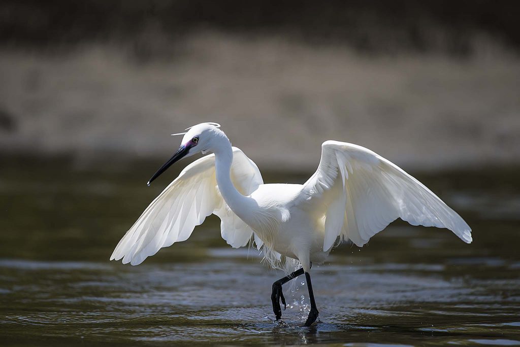
The area of Cotton Tree is generally bounded by the Maroochy River and Cornmeal Creek to the north and to the south and west by Aerodrome Road and by the Pacific Ocean to the east. The area takes its name from the Hibiscus tiliaceus plant which is also known as Coastal Cotton tree or Cottonwood.… Continue reading Cotton Tree, Maroochydore, An Excellent Haven For Water Bird Photography
Author: Geoff
Capturing the Brightness Of The Sunflowers
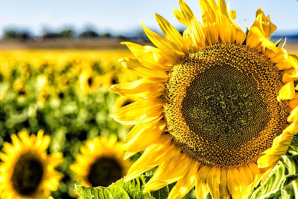
Sunflowers are tall plants that grow to a height of around 300 centimetres. They bear one or more wide flower heads, with bright yellow ray florets at the outside and yellow or maroon (brown/red) disc florets inside. During their growth period, the sunflowers tilt during the day to face the sun, but they stop tilting… Continue reading Capturing the Brightness Of The Sunflowers
Images From Bjelke Petersen Dam (Lake Barambah), Queensland With The Nikon Nikkor 200-500mm f/5.6E ED VR AF-S Lens
The Bjelke Petersen Dam was constructed over the period 1984 to 1988. The lake was originally named Lake Barambah after the original property in the region and has since been renamed the Bjelke Petersen Dam. The dam supplies water to the South Burnett region of Queensland, for irrigation purposes and also nearby towns for town… Continue reading Images From Bjelke Petersen Dam (Lake Barambah), Queensland With The Nikon Nikkor 200-500mm f/5.6E ED VR AF-S Lens
Images From Running Creek Parklands, Queensland
Running Creek Parklands is a bush camping area off Bellthorpe Range Rd, Stanmore, Queensland. just a short distance from Woodford. There is a creek running through the camping area which flows for the major part of the year with the exception of very dry spells. The above image was captured very early on a foggy… Continue reading Images From Running Creek Parklands, Queensland
The Woorolin Grain Silos
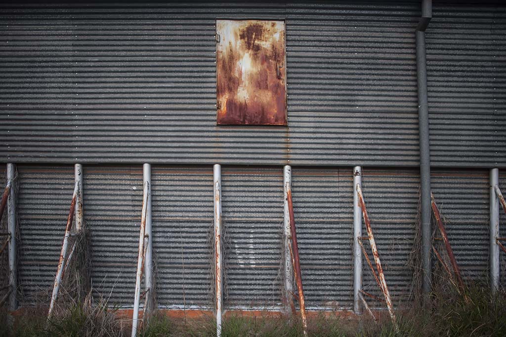
Wooroolin is a town in the South Burnett region of Queensland, Australia on the Bunya Highway, around 250 kilometres north west of Brisbane the state capital. To the eastern side of the town is the Wooroolin Wetland, a non tidal, inland, seasonally flooded, vegetated swamp. In recent times the wetland has flooded and burst its… Continue reading The Woorolin Grain Silos
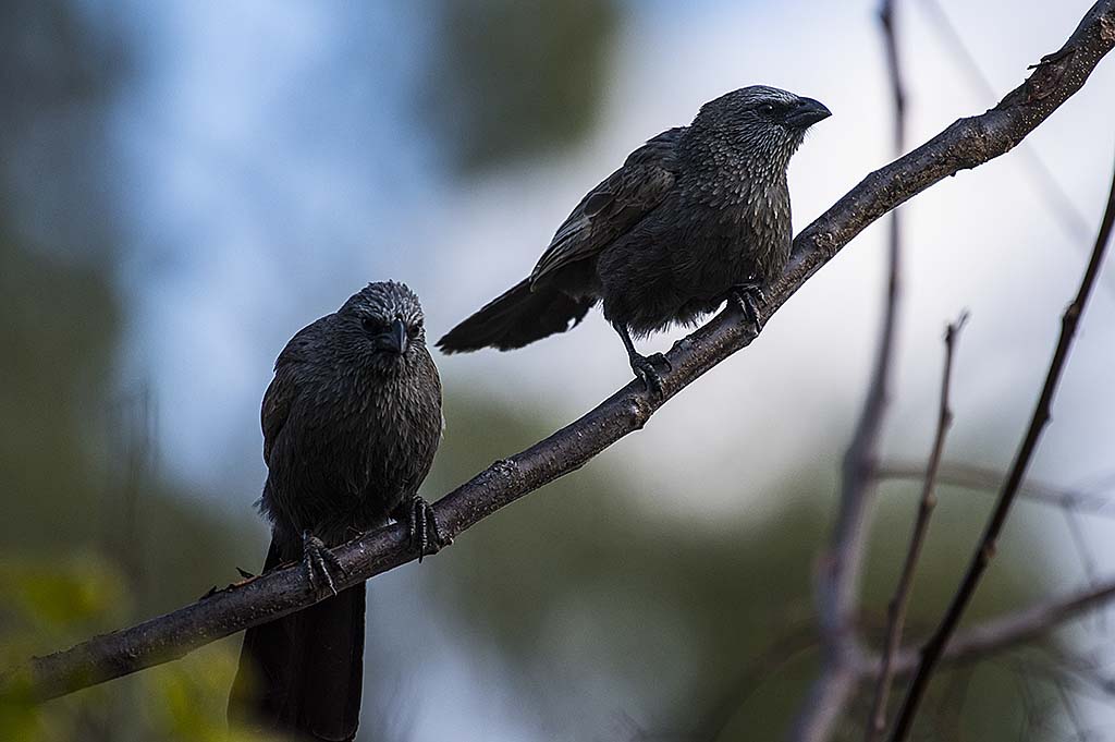
Some Birds From Kingaroy, The Peanut Factory
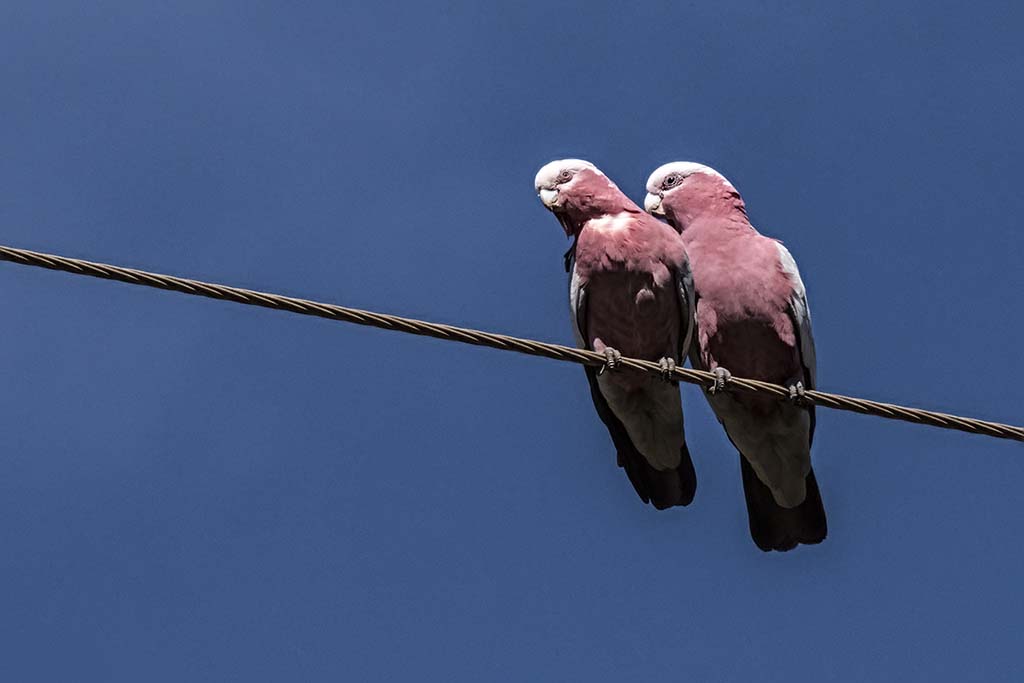
Kingaroy is quite a large agricultural town in the South Burnett Region of Queensland, Australia. It is approximately 200 kilometres north-west of Brisbane the state capital of Queensland. The town is situated at the junction of the D’Aguilar and the Bunya Highways. Kingaroy is known as the “Peanut Capital of Australia”. Australia’s largest peanut processing… Continue reading Some Birds From Kingaroy, The Peanut Factory
Ban Ban Springs – Aboriginal Sacred Ground – Great Bird Photography Area With The Nikon 200-500mm f/5.6E ED VR AF-S Lens
Ban Ban Springs is a very small community located at the junction of the Burnett and Isis highways in Queensland, Australia. On the southern side of the road junction are the springs from which the area gets its name, being springs from which waters flow into the nearby Barambah Creek. “Ban Ban” has the meaning grass… Continue reading Ban Ban Springs – Aboriginal Sacred Ground – Great Bird Photography Area With The Nikon 200-500mm f/5.6E ED VR AF-S Lens
Images From The Wondai Town, Queensland
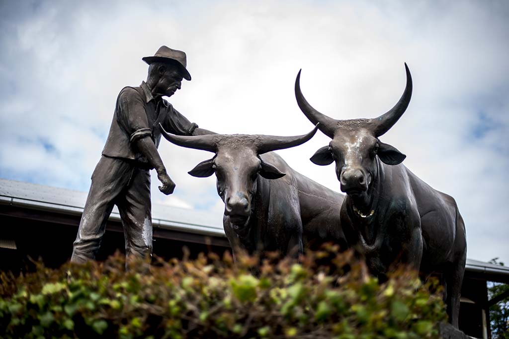
Wondai is a small town in the South Burnett Region of Queensland, Australia. The town is located to the south of the Bunya Highway, around 250 kilometres north west of Brisbane, the state capital of Queensland. The population is around 2,000 people. There is a Timber Museum which showcases the history of the South Burnett’s… Continue reading Images From The Wondai Town, Queensland
Images From Moore, Queensland
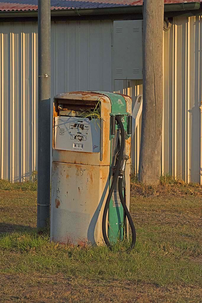
Moore is a very small town in the Somerset Region of South East Queensland, Australia. The town is 96 kilometres north-west of Brisbane. The population including the surrounding area is only around 315 people. Moore is located at the base of the Balfour Range between the town of Esk in the Brisbane River valley and… Continue reading Images From Moore, Queensland
Images From Biggenden, Queensland
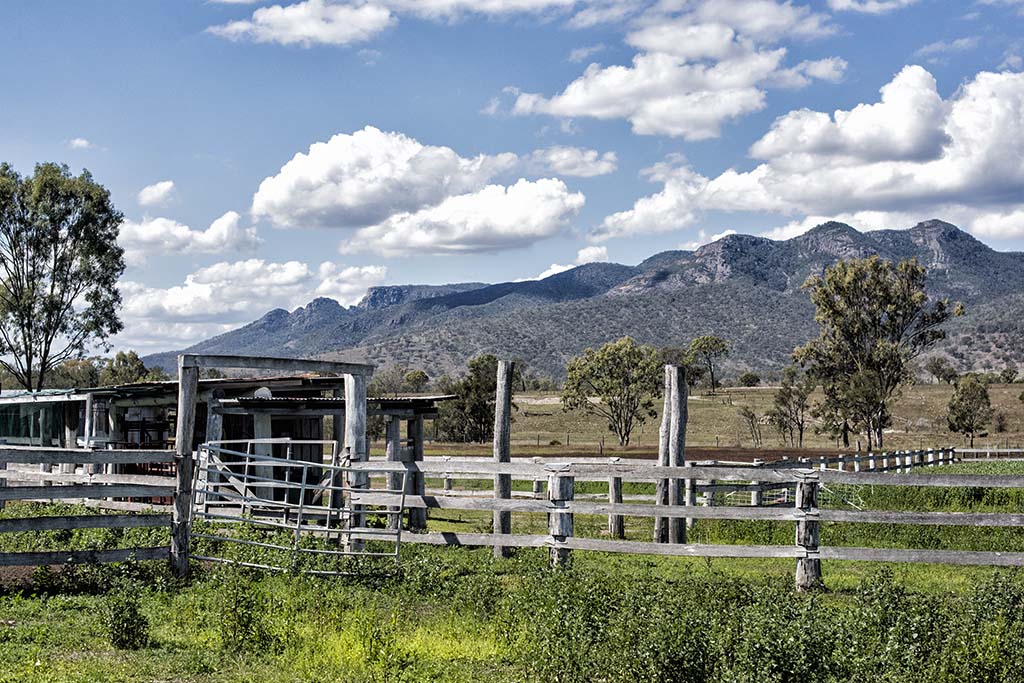
Biggenden is a small settlement in the North Burnett Region of Queensland. It is on the Isis Highway around 340 kilometres north west of the state capital Brisbane and 80 kilometres west of Maryborough. Here are few images from the rural area around Biggenden. The old weathered timber fences always form a nice foreground for this scene… Continue reading Images From Biggenden, Queensland